Commonwealth Marine Economies Programme [logo]Commonwealth Marine Economies Programme
  • About
  • Countries
  • Projects
  • Publications
  • Workshops
  • News
  • Media
  • Search
  • Antigua and Barbuda
  • Belize
  • Dominica
  • Fiji
  • Grenada
  • Guyana
  • Jamaica
  • Kiribati
  • Nauru
  • Papua New Guinea
  • Samoa
  • Seychelles
  • Solomon Islands
  • St Lucia
  • St Vincent and the Grenadines
  • Tonga
  • Tuvalu
  • Vanuatu
  • Autonomous seawater monitoring equipment
  • CME Programme fellowship network
  • Characterisation of ocean acidification over decadal timescales
  • Containerised Autonomous Marine Environmental Laboratory (CAMEL)
    • CAMEL Specification
  • Creation of a coastal data hub for the Caribbean
  • Extension of the anyTide app
  • Habitat mapping to support marine spatial planning
  • Impact of land use change on marine environments
  • Marine Data Management
  • Ocean modelling and monitoring
  • Phytoplankton sensitivity assessment
  • Sustainable deep-sea ocean resource exploitation
  • Telecommunication resilience and geohazard characterisation
  • Tide gauge installation
  • Virtual Workshop CMEP 2021
  1. Countries
  2. Solomon Islands
Previous Next

Solomon Islands

Projects
Extension of the anyTide app
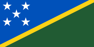
Flag of the Solomon Islands
Location
+−
Leaflet | © OpenStreetMap contributors
  • National Oceanography Centre logo

© 2025  The National Oceanography Centre (NOC) or its partners owns copyright of the material available at this site, unless otherwise stated. All rights reserved.

  • Disclaimer
  • Privacy and cookies
  • Cookie settings
  • Contact us
We use cookies to aid user experience. Accept, reject or revoke consent at any time in “Cookie settings”.
  • Privacy and cookies
  • About
  • Countries
    +
    −
    • Antigua and Barbuda
    • Belize
    • Dominica
    • Fiji
    • Grenada
    • Guyana
    • Jamaica
    • Kiribati
    • Nauru
    • Papua New Guinea
    • Samoa
    • Seychelles
    • Solomon Islands
    • St Lucia
    • St Vincent and the Grenadines
    • Tonga
    • Tuvalu
    • Vanuatu
  • Projects
    +
    −
    • Autonomous seawater monitoring equipment
    • CME Programme fellowship network
    • Characterisation of ocean acidification over decadal timescales
    • Containerised Autonomous Marine Environmental Laboratory (CAMEL)
      +
      −
      • CAMEL Specification
    • Creation of a coastal data hub for the Caribbean
    • Extension of the anyTide app
    • Habitat mapping to support marine spatial planning
    • Impact of land use change on marine environments
    • Marine Data Management
    • Ocean modelling and monitoring
    • Phytoplankton sensitivity assessment
    • Sustainable deep-sea ocean resource exploitation
    • Telecommunication resilience and geohazard characterisation
    • Tide gauge installation
  • Publications
  • Workshops
    +
    −
    • Virtual Workshop CMEP 2021
  • News
  • Media
  • Search